|
The Geology of the Verwood Area
|
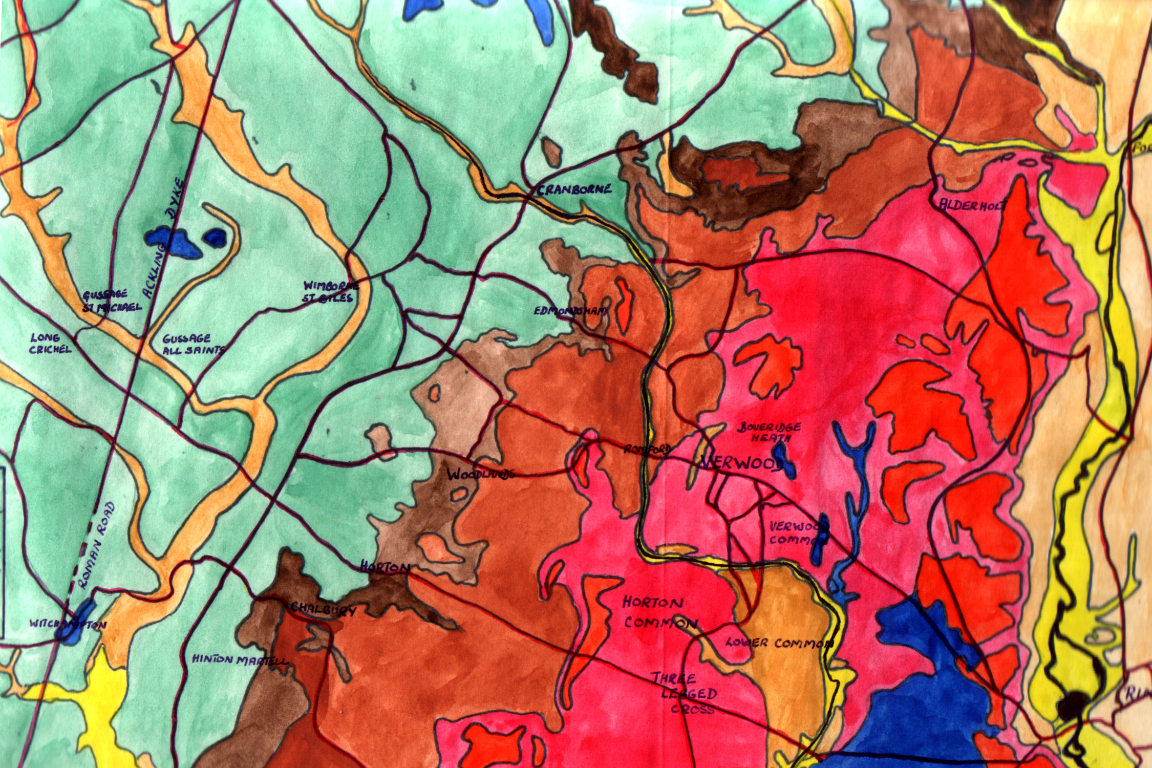
Geologically Verwood is situated in the Hampshire Basin
and is on the south western fringe of the New Forest. Romford on the western edge
of the village is within the London Clay belt, this area is
mostly given up to woodland, pasture and arable farming
where wheat, barley and oats are grown. Two brickyards were in this
area.

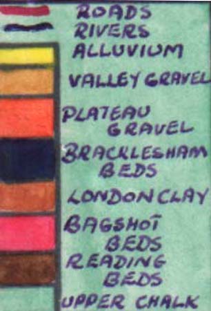
Most of the village has a sandy soil being part of
the Bagshot Beds of this area. It is a light, buff colour
quartz-sand giving a wild, "heathy land". A vein
of strong clay gave rise to many potteries in the area.
A narrow outcrop of Bracklesham Beds occurs at
Ebblake on the Hampshire-Dorset border, where the soil is
alternating clay and sand. This clay was used for
brick-making and produced white bricks which were used to
decorate some local houses. This area is now part of
Ringwood Forest.
Another brickyard was situated halfway between
Ebblake and the centre, of Verwood on another clay seam.
Plateau gravels are found at Redman's Hill, Pistle
Down and Wedge Hill. Valley
gravel occurs in the Lower Common area at Potterne and Three
Legged Cross, as a gravel, a few feet above the river
alluvium.
An historian has described the area as "an
extensive: tract of heathy land, of a wild and desolate
aspect".
Copyright © P Reeks.
|